Geolocate

Nolokla topographic map

Click on the map to display elevation.

About this map

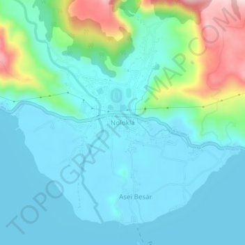
Name: Nolokla topographic map, elevation, terrain.

Location: Nolokla, Jayapura, Papua, Western New Guinea, Indonesia (-2.60339 140.55451 -2.56339 140.59451)

Average elevation: 142 m

Minimum elevation: 73 m

Maximum elevation: 407 m

Gear up for your next adventure:

🛌Insulated Sleeping Pad - Critical thermal barrier between you and the cold ground
🧥Thermal Layer - Insulating layer for cold outdoor conditions
💧Reusable Water Bottle - Durable water bottles for hydration on trails
🦌Outdoor Trail Camera - Monitor wildlife activity near your favorite spots
🧣Merino Neck Gaiter - Protects against wind, sun, and cold at high altitudes

As an Amazon Associate, this site earns from qualifying purchases at no extra cost to you.