
Blue Knob topographic map
Click on the map to display elevation.
Blue Knob
Blue Knob (elevation 3,146 feet (959 m)) is a summit in the eastern United States with a broad dome that is the northernmost 3,000-footer in the Allegheny Mountains. It is the highest point in Bedford County, Pennsylvania.
About this map
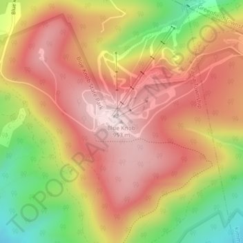
Name: Blue Knob topographic map, elevation, terrain.
Average elevation: 792 m
Minimum elevation: 546 m
Maximum elevation: 957 m