Geolocate

Korla topographic map

Click on the map to display elevation.

About this map

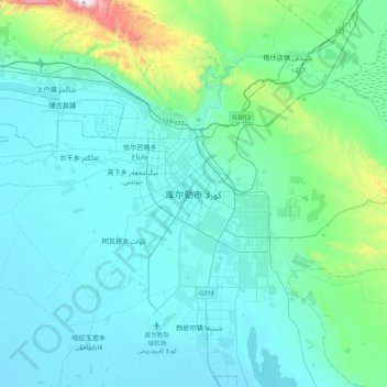
Name: Korla topographic map, elevation, terrain.

Location: Korla, Korla City, Bayingolin, Xinjiang, 841000, China (41.56387 86.01354 41.88387 86.33354)

Average elevation: 1,034 m

Minimum elevation: 898 m

Maximum elevation: 2,027 m

Gear up for your next adventure:

🥾Mountain Hiking Boots - High-traction boots for rocky terrain
🧢Hiking Hat - Sun-protective and breathable hats for long treks
🥾Hiking Shoes - Durable and comfortable shoes for trail hiking
🪑Ultralight Camping Stool - Compact seating for rest stops during long hikes
🥾Approach Boots - Comfortable boots for hiking and climbing approaches

As an Amazon Associate, this site earns from qualifying purchases at no extra cost to you.