Geolocate

Patnam topographic map

Click on the map to display elevation.

About this map

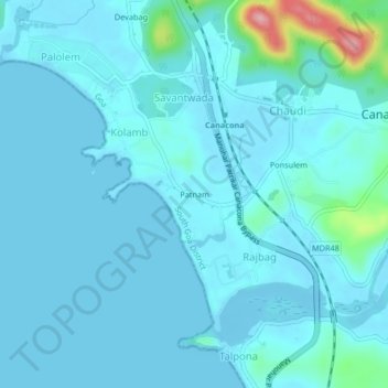
Name: Patnam topographic map, elevation, terrain.

Location: Patnam, Canacona, South Goa, Goa, 403702, India (14.97859 74.01627 15.01859 74.05627)

Average elevation: 15 m

Minimum elevation: -3 m

Maximum elevation: 149 m

Other topographic maps

Click on a map to view its topography, its elevation and its terrain.

Chapoli Dam

India > Goa > Canacona > Canacona

Average elevation: 54 m

Butterfly Beach

India > Goa > Canacona

Average elevation: 28 m

Gear up for your next adventure:

👟Trail Running Shoes - Agile footwear for fast-paced topographic exploration
🪑Insulated Seat Pad - Protect your seat from cold rocks and wet logs
🎒Hiking Backpack - Lightweight and ergonomic backpacks for day hikes or multi-day treks
🌬️Windproof Camp Stove - Efficient cooking even on exposed mountain peaks
🔋Emergency Crank Radio - Weather alerts and power without needing batteries

As an Amazon Associate, this site earns from qualifying purchases at no extra cost to you.