Geolocate

Tudi topographic map

Click on the map to display elevation.

About this map

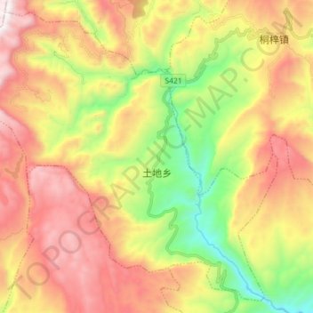
Name: Tudi topographic map, elevation, terrain.

Location: Tudi, Wulong District, Chongqing, China (29.45485 107.81364 29.56847 107.95492)

Average elevation: 1,054 m

Minimum elevation: 279 m

Maximum elevation: 1,855 m

Gear up for your next adventure:

🥾Trail Hiking Boots - Supportive boots for rough trails
🥫Freeze-Dried Meals - Lightweight, high-calorie nutrition for multi-day treks
💧Hydration Pack - Hands-free hydration system for long hikes
🛶Kayak Dry Bag - Waterproof storage for kayaking adventures
🕯️Camping Lantern - Illuminates your entire campsite with high-efficiency LEDs

As an Amazon Associate, this site earns from qualifying purchases at no extra cost to you.