
Easton topographic map
Interactive map
Click on the map to display elevation.
About this map
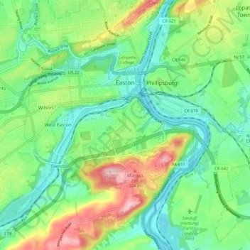
Name: Easton topographic map, elevation, terrain.
Location: Easton, Northampton County, Pennsylvania, USA (40.64074 -75.28374 40.71666 -75.19015)
Average elevation: 109 m
Minimum elevation: 43 m
Maximum elevation: 245 m