Geolocate

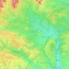
Dibden topographic map

Click on the map to display elevation.

About this map

Name: Dibden topographic map, elevation, terrain.

Location: Dibden, New Forest, Hampshire, England, SO45 5UL, United Kingdom (50.84653 -1.44781 50.88653 -1.40781)

Average elevation: 17 m

Minimum elevation: -2 m

Maximum elevation: 42 m

Other topographic maps

Click on a map to view its topography, its elevation and its terrain.
Brockenhurst

United Kingdom > England > Hampshire > New Forest

Average elevation: 34 m

Gear up for your next adventure:

👟Sport Hiking Sandals - Breathable footwear for water crossings and camp rest
🥽Outdoor Goggles - Protective eyewear for outdoor activities
🧴Waterproofing Spray - Restore the DWR coating on jackets and tents
🍽️Titanium Camping Spork - Ultralight and indestructible eating utensil
🧭Orienteering Kit - Tools for map reading and navigation in the wild

As an Amazon Associate, this site earns from qualifying purchases at no extra cost to you.