Geolocate

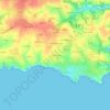
Saint-Julien topographic map

Click on the map to display elevation.

About this map

Name: Saint-Julien topographic map, elevation, terrain.

Location: Saint-Julien, Le Pouldu, Clohars-Carnoët, Quimper, Finistère, Brittany, Metropolitan France, 29360, France (47.76674 -3.53589 47.76884 -3.53237)

Average elevation: 15 m

Minimum elevation: -2 m

Maximum elevation: 46 m

Other topographic maps

Click on a map to view its topography, its elevation and its terrain.
Bellangenet

France > Brittany > Finistère > Le Pouldu

Average elevation: 15 m

Le Kerou Village

France > Brittany > Finistère > Le Pouldu

Average elevation: 22 m

Gear up for your next adventure:

🧰Multitool Knife - Compact and versatile tool for outdoor use
🥾Mountain Hiking Shoes - Shoes with superior grip for mountainous terrain
🏕️Camping Hammock - Integrated protection for sleeping between trees
🥾Trekking Boots - Durable boots for long-distance trekking
🌡️Emergency Mylar Blankets - Compact thermal protection for unexpected nights outdoors

As an Amazon Associate, this site earns from qualifying purchases at no extra cost to you.