Geolocate

Pampamarca topographic map

Click on the map to display elevation.

About this map

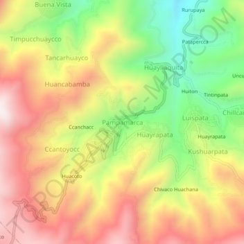
Name: Pampamarca topographic map, elevation, terrain.

Location: Pampamarca, Talavera, Andahuaylas, Apurímac, Perú (-13.72566 -73.47984 -13.68566 -73.43984)

Average elevation: 3,492 m

Minimum elevation: 3,085 m

Maximum elevation: 3,866 m

Gear up for your next adventure:

🔋Lithium AA Batteries - Long-lasting power that performs in extreme cold
🧦Crew Hiking Socks - Comfortable socks for long-distance hikes
🧥Thermal Layer - Insulating layer for cold outdoor conditions
Camping Coffee Maker - Brew fresh coffee anywhere on the topographic map
🔨Vehicle Emergency Tool - Safety tool for remote road trips to trailheads

As an Amazon Associate, this site earns from qualifying purchases at no extra cost to you.