Geolocate

Cardinal topographic map

Click on the map to display elevation.

About this map

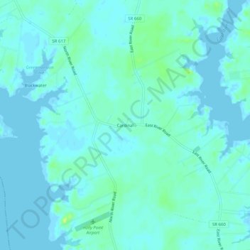
Name: Cardinal topographic map, elevation, terrain.

Location: Cardinal, Mathews County, Virginia, 23025, United States (37.40042 -76.40161 37.44042 -76.36161)

Average elevation: 4 m

Minimum elevation: -4 m

Maximum elevation: 17 m

Gear up for your next adventure:

Camping Coffee Maker - Brew fresh coffee anywhere on the topographic map
🔥Camping Stove - Portable stoves to cook outdoors with ease
🥾Mountaineering Boots - Supportive boots for climbing and high-altitude hiking
🏕️Camping Hammock - Integrated protection for sleeping between trees
🛶Kayak Accessories - Essential gear for safe and fun kayaking adventures

As an Amazon Associate, this site earns from qualifying purchases at no extra cost to you.