Geolocate

Lost City topographic map

Click on the map to display elevation.

About this map

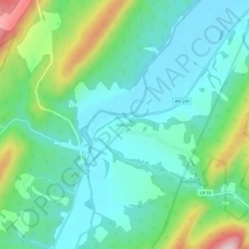
Name: Lost City topographic map, elevation, terrain.

Location: Lost City, Hardy County, West Virginia, United States (38.91076 -78.85383 38.95076 -78.81383)

Average elevation: 506 m

Minimum elevation: 419 m

Maximum elevation: 761 m

Gear up for your next adventure:

🕶️Polarized Sunglasses - Protect your eyes with durable polarized lenses
🔭Outdoor Binoculars - Lightweight binoculars for birdwatching and hiking
🥾Hiking Boots - Sturdy boots providing ankle support and traction on rugged trails
🥾All-Terrain Hiking Boots - Versatile boots for varied hiking conditions
🧰Multitool Knife - Compact and versatile tool for outdoor use

As an Amazon Associate, this site earns from qualifying purchases at no extra cost to you.