
Make a donation
Gear up for your next adventure:
As an Amazon Associate, this site earns from qualifying purchases at no extra cost to you.
Mühlhofen topographic map
Click on the map to display elevation.
Make a donation
Gear up for your next adventure:
As an Amazon Associate, this site earns from qualifying purchases at no extra cost to you.
About this map
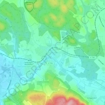
Name: Mühlhofen topographic map, elevation, terrain.
Average elevation: 438 m
Minimum elevation: 396 m
Maximum elevation: 561 m
Make a donation
Gear up for your next adventure:
As an Amazon Associate, this site earns from qualifying purchases at no extra cost to you.
Other topographic maps
Click on a map to view its topography, its elevation and its terrain.
Tettnang
Deutschland > Baden-Württemberg > Bodenseekreis
Die Stadt liegt etwa neun Kilometer nordöstlich von Friedrichshafen und 13 Kilometer südlich von Ravensburg im Hinterland des Bodensees, etwa 70 Höhenmeter über dem See. Von manchem Standort aus bietet sich daher ein weiter Panoramablick auf das „Schwäbische Meer“ und die Alpenkette, vor allem auf die…
Average elevation: 457 m
Überlingen
Deutschland > Baden-Württemberg > Bodenseekreis
Bei Überlingen-Bonndorf ergibt sich von der Höhe des Haldenhofs aus ein Blick auf den Überlinger See.
Average elevation: 525 m
Make a donation
Gear up for your next adventure:
As an Amazon Associate, this site earns from qualifying purchases at no extra cost to you.