
Hardwick topographic map
Interactive map
Click on the map to display elevation.
About this map
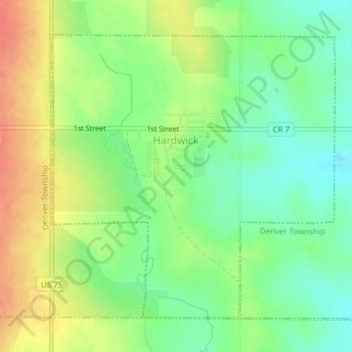
Name: Hardwick topographic map, elevation, terrain.
Location: Hardwick, Rock County, Minnesota, 56134, United States (43.76116 -96.21253 43.78296 -96.18238)
Average elevation: 490 m
Minimum elevation: 466 m
Maximum elevation: 519 m
Other topographic maps
Click on a map to view its topography, its elevation and its terrain.
Hills
United States > Minnesota > Rock County
Hills, Martin Township, Rock County, Minnesota, 56138, United States
Average elevation: 445 m