Geolocate

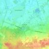
Werlte topographic map

Click on the map to display elevation.

About this map

Name: Werlte topographic map, elevation, terrain.

Location: Werlte, Samtgemeinde Werlte, Landkreis Emsland, Nedersaksen, 49757, Duitsland (52.79145 7.56898 52.91737 7.74093)

Average elevation: 34 m

Minimum elevation: 19 m

Maximum elevation: 49 m

Other topographic maps

Click on a map to view its topography, its elevation and its terrain.

Gleesen

Duitsland > Nedersaksen > Landkreis Emsland

Average elevation: 29 m

Neusustrum

Duitsland > Nedersaksen > Landkreis Emsland

Average elevation: 11 m

Hesselte

Duitsland > Nedersaksen > Landkreis Emsland > Emsbüren

Average elevation: 31 m

Sprakel

Duitsland > Nedersaksen > Landkreis Emsland > Stavern

Average elevation: 39 m

Sand

Duitsland > Nedersaksen > Landkreis Emsland > Oberlangen

Average elevation: 10 m

Haar

Duitsland > Nedersaksen > Landkreis Emsland > Haren (Ems)

Average elevation: 15 m

Gear up for your next adventure:

🥾Mountaineering Boots - Supportive boots for climbing and high-altitude hiking
⛺Backpacking Tent - Lightweight tent for long-distance hiking trips
🥾Mountain Hiking Shoes - Shoes with superior grip for mountainous terrain
🕯️Camping Lantern - Illuminates your entire campsite with high-efficiency LEDs
🛶Canoe Life Vest - Safety vest for water sports

As an Amazon Associate, this site earns from qualifying purchases at no extra cost to you.