Geolocate

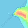
Maitland topographic map

Click on the map to display elevation.

About this map

Name: Maitland topographic map, elevation, terrain.

Location: Maitland, Yorke Peninsula Council, South Australia, 5573, Australia (-34.42969 137.54199 -34.27599 137.83436)

Average elevation: 129 m

Minimum elevation: 12 m

Maximum elevation: 244 m

Other topographic maps

Click on a map to view its topography, its elevation and its terrain.
Gear up for your next adventure:

🧤Rechargeable Heated Gloves - Extreme warmth for Canadian winter expeditions
🔦LED Headlamp - Hands-free lighting for early morning starts or late finishes
🛏️Sleeping Bag - Warm and compact sleeping bags for outdoor camping
🦯Trekking Poles - Reduced impact on joints for steep topographic climbs
🕶️Polarized Sunglasses - Reduces glare from snow and water at high elevations

As an Amazon Associate, this site earns from qualifying purchases at no extra cost to you.