Geolocate

Zumpango topographic map

Click on the map to display elevation.

About this map

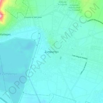
Name: Zumpango topographic map, elevation, terrain.

Location: Zumpango, State of Mexico, 55600, Mexico (19.75729 -99.14073 19.83729 -99.06073)

Average elevation: 2,257 m

Minimum elevation: 2,236 m

Maximum elevation: 2,421 m

Gear up for your next adventure:

🧥Fleece Jacket - Warm and lightweight jacket for layering
🏃Hydration Running Vest - Carry water and maps close to your body for speed
👟Leg Gaiters - Keep debris, mud, and snow out of your boots
🕶️Polarized Sunglasses - Protect your eyes with durable polarized lenses
🥾Trekking Poles - Adjustable trekking poles to reduce knee stress and improve stability

As an Amazon Associate, this site earns from qualifying purchases at no extra cost to you.