
Thank you for supporting this site ❤️
Make a donation
Make a donation
Gear up for your next adventure:
As an Amazon Associate, this site earns from qualifying purchases at no extra cost to you.
Zaprešić topographic map
Click on the map to display elevation.
Thank you for supporting this site ❤️
Make a donation
Make a donation
Gear up for your next adventure:
As an Amazon Associate, this site earns from qualifying purchases at no extra cost to you.
About this map
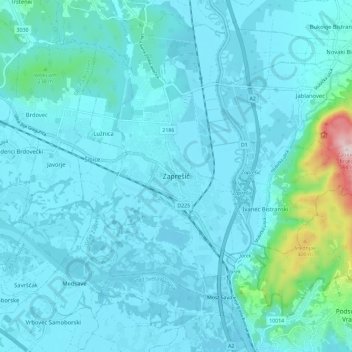
Name: Zaprešić topographic map, elevation, terrain.
Location: Zaprešić, Town of Zaprešić, Zagreb County, 10290, Croatia (45.81727 15.76504 45.89727 15.84504)
Average elevation: 162 m
Minimum elevation: 118 m
Maximum elevation: 573 m
Thank you for supporting this site ❤️
Make a donation
Make a donation
Gear up for your next adventure:
As an Amazon Associate, this site earns from qualifying purchases at no extra cost to you.