Geolocate

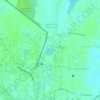
Zone 2 Manali topographic map

Click on the map to display elevation.

About this map

Name: Zone 2 Manali topographic map, elevation, terrain.

Location: Zone 2 Manali, Chennai, Mathavaram, Thiruvallur, Tamil Nadu, India (13.15996 80.20882 13.22744 80.31304)

Average elevation: 6 m

Minimum elevation: -3 m

Maximum elevation: 15 m

Other topographic maps

Click on a map to view its topography, its elevation and its terrain.
Retteri Lake

India > Tamil Nadu > Mathavaram > Chennai

Average elevation: 10 m

Vadaperumbakkam

India > Tamil Nadu > Mathavaram > Chennai

Average elevation: 8 m

Thazhankuppam

India > Tamil Nadu > Mathavaram > Chennai

Average elevation: 2 m

Kanniyampettai

India > Tamil Nadu > Mathavaram > Chennai

Average elevation: 4 m

Vadaperumbakkam

India > Tamil Nadu > Mathavaram > Chennai

Average elevation: 8 m

Vadaperumbakkam

India > Tamil Nadu > Mathavaram > Chennai

Average elevation: 8 m

Kosappur

India > Tamil Nadu > Mathavaram > Chennai

Average elevation: 6 m

Thazhankuppam

India > Tamil Nadu > Mathavaram > Chennai

Average elevation: 2 m

Kanniyampettai

India > Tamil Nadu > Mathavaram > Chennai

Average elevation: 4 m

Thazhankuppam

India > Tamil Nadu > Mathavaram > Chennai

Average elevation: 2 m

Gear up for your next adventure:

🥾Durable Hiking Shoes - Long-lasting shoes for frequent hiking
💧Filtered Water Bottle - Safe drinking water on the go
⛺Family Camping Tent - Spacious tent suitable for family camping trips
🎒Hiking Backpack - Lightweight and ergonomic backpacks for day hikes or multi-day treks
🥾Trail Running Shoes - Lightweight and durable shoes for trail running

As an Amazon Associate, this site earns from qualifying purchases at no extra cost to you.