Geolocate

Pucalpillo topographic map

Click on the map to display elevation.

About this map

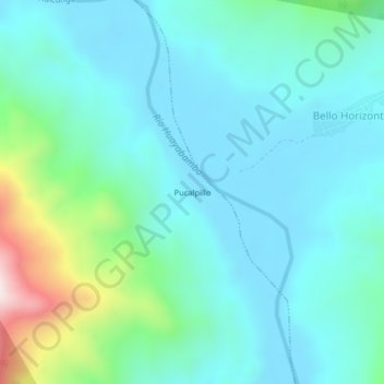
Name: Pucalpillo topographic map, elevation, terrain.

Location: Pucalpillo, Huicungo, Mariscal Cáceres, San Martín, Perú (-7.24715 -77.01326 -7.20715 -76.97326)

Average elevation: 451 m

Minimum elevation: 320 m

Maximum elevation: 1,011 m

Gear up for your next adventure:

🥾Mountain Trail Shoes - High-traction shoes for mountain trails
🧴Bear Spray Holster - Quick-access carry for essential Canadian wilderness safety
🧭GPS Handheld Device - Reliable GPS navigation for outdoor adventures
🦶Anti-Blister Balm - Prevents friction and hotspots during long ascents
Camping Essentials - All-in-one gear for a comfortable camping trip

As an Amazon Associate, this site earns from qualifying purchases at no extra cost to you.