Geolocate

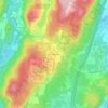
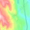
Thetford topographic map

Click on the map to display elevation.

About this map

Name: Thetford topographic map, elevation, terrain.

Location: Thetford, Orange County, Vermont, United States (43.77132 -72.33934 43.89982 -72.16817)

Average elevation: 273 m

Minimum elevation: 111 m

Maximum elevation: 563 m

Other topographic maps

Click on a map to view its topography, its elevation and its terrain.

Lake Morey

United States > Vermont > Orange County > Fairlee

Average elevation: 205 m

East Topsham

United States > Vermont > Orange County > Topsham

Average elevation: 387 m

East Orange

United States > Vermont > Orange County > Orange

Average elevation: 477 m

Union Village

United States > Vermont > Orange County

Average elevation: 217 m

Thetford Hill

United States > Vermont > Orange County

Average elevation: 249 m

South Randolph

United States > Vermont > Orange County > Randolph

Average elevation: 268 m

Corinth Corners

United States > Vermont > Orange County > Corinth

Average elevation: 502 m

Thetford

United States > Vermont > Orange County > Thetford

Average elevation: 268 m

Annis Hill

United States > Vermont > Orange County > Chelsea

Average elevation: 511 m

West Newbury

United States > Vermont > Orange County > Newbury

Average elevation: 311 m

Cookville

United States > Vermont > Orange County > Corinth

Average elevation: 363 m

Mill Village

United States > Vermont > Orange County > Vershire

Average elevation: 429 m

Gear up for your next adventure:

🧦Hiking Socks - Moisture-wicking and comfortable socks for long hikes
🧥Waterproof Jacket - Lightweight rain jackets for hiking and outdoor activities
🗺️Topographic Maps - Detailed maps to explore trails, mountains, and wilderness areas
🛏️Sleeping Bag - Warm and compact sleeping bags for outdoor camping
🧴First Aid Kit - Essential first aid supplies for outdoor emergencies

As an Amazon Associate, this site earns from qualifying purchases at no extra cost to you.