Geolocate

Louisville topographic map

Click on the map to display elevation.

About this map

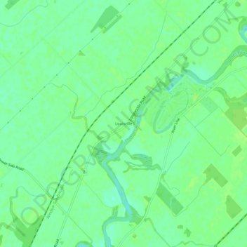
Name: Louisville topographic map, elevation, terrain.

Location: Louisville, Chatham, Chatham-Kent, Ontario, Canada (42.45792 -82.13858 42.49792 -82.09858)

Average elevation: 184 m

Minimum elevation: 177 m

Maximum elevation: 188 m

Chatham-Kent trails, hiking, mountain biking, running and outdoor activities

Other topographic maps

Click on a map to view its topography, its elevation and its terrain.

Blythe Park

Canada > Ontario > Chatham-Kent > Chatham

Average elevation: 182 m

Harwich

Canada > Ontario > Chatham-Kent > Chatham

Average elevation: 189 m

Gear up for your next adventure:

Family Camping Tent - Spacious tent suitable for family camping trips
🔦LED Headtorch - Bright and durable light for night activities
🔋Lithium AA Batteries - Long-lasting power that performs in extreme cold
🥾Mountaineering Boots - Supportive boots for climbing and high-altitude hiking
🚲MTB Frame Bag - Carry tools and maps directly on your bicycle frame

As an Amazon Associate, this site earns from qualifying purchases at no extra cost to you.