Geolocate

Savage topographic map

Click on the map to display elevation.

About this map

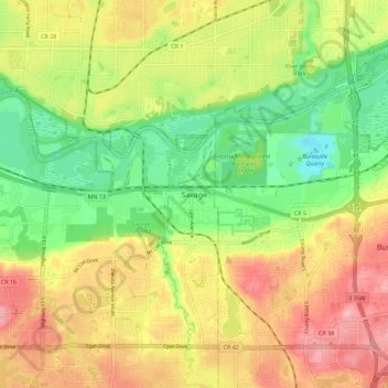
Name: Savage topographic map, elevation, terrain.

Location: Savage, Scott County, Minnesota, 55378, United States (44.73790 -93.37562 44.81790 -93.29562)

Average elevation: 251 m

Minimum elevation: 186 m

Maximum elevation: 321 m

Gear up for your next adventure:

🥾Light Hiking Boots - Lightweight and comfortable boots for day hikes
🧰Survival Kit - Essential gear for emergencies in the wilderness
💡LED Headlamp - Hands-free illumination for night hiking and camping
🛶Waterproof Dry Bags - Keep electronics and clothes dry during river crossings
🧴Sunscreen SPF - Broad-spectrum sunscreen for outdoor activities

As an Amazon Associate, this site earns from qualifying purchases at no extra cost to you.