Geolocate

Bisignano topographic map

Click on the map to display elevation.

About this map

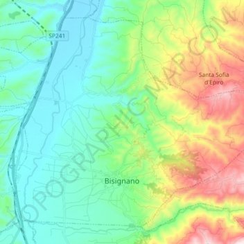
Name: Bisignano topographic map, elevation, terrain.

Location: Bisignano, Cosenza, Calabria, Italy (39.47901 16.21139 39.57486 16.35606)

Average elevation: 256 m

Minimum elevation: 57 m

Maximum elevation: 770 m

Gear up for your next adventure:

🥾Trekking Boots - Durable boots for long-distance trekking
🥾Mountain Trail Shoes - High-traction shoes for mountain trails
👟Trail Running Shoes - Agile footwear for fast-paced topographic exploration
🧢Outdoor Visor - Breathable visor for sunny hikes
🚲MTB Frame Bag - Carry tools and maps directly on your bicycle frame

As an Amazon Associate, this site earns from qualifying purchases at no extra cost to you.