Geolocate

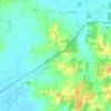
Griffin topographic map

Click on the map to display elevation.

About this map

Name: Griffin topographic map, elevation, terrain.

Location: Griffin, Posey County, Indiana, United States (38.20051 -87.91621 38.20800 -87.91298)

Average elevation: 120 m

Minimum elevation: 109 m

Maximum elevation: 150 m

Other topographic maps

Click on a map to view its topography, its elevation and its terrain.
Caborn

United States > Indiana > Posey County

Average elevation: 126 m

New Harmony

United States > Indiana > Posey County > New Harmony

Average elevation: 121 m

Gear up for your next adventure:

🥾Mountain Trail Shoes - High-traction shoes for mountain trails
🧭GPS Outdoor Watch - Smart watch for navigation and fitness tracking in nature
🚑Survival Whistle - Signal for help across long distances in mountains
🥾Durable Hiking Shoes - Long-lasting shoes for frequent hiking
🥾Waterproof Trail Shoes - Shoes designed to handle wet terrain

As an Amazon Associate, this site earns from qualifying purchases at no extra cost to you.