
Jhargram topographic map
Click on the map to display elevation.
Jhargram
Jhargram is located at 22°27′N 86°59′E / 22.45°N 86.98°E / 22.45; 86.98. It has an average elevation of 81 metres (265 feet). The weather, like much of Bengal, is extremely humid and tropical. Temperatures can reach as high as 46 °C in the hot and dry months of May and June but can plummet to 4 °C in the chilly nights of December and January.
About this map
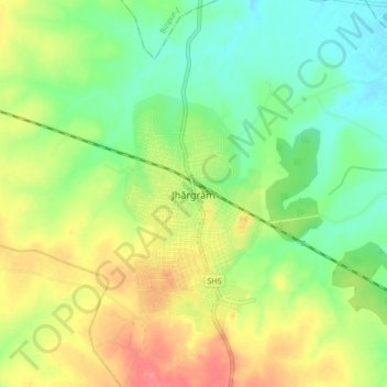
Name: Jhargram topographic map, elevation, terrain.
Location: Jhargram, West Bengal, 721507, India (22.41385 86.95495 22.49385 87.03495)
Average elevation: 79 m
Minimum elevation: 51 m
Maximum elevation: 116 m