
Thank you for supporting this site ❤️
Make a donation
Make a donation
Gear up for your next adventure:
As an Amazon Associate, this site earns from qualifying purchases at no extra cost to you.
Serém topographic map
Click on the map to display elevation.
Thank you for supporting this site ❤️
Make a donation
Make a donation
Gear up for your next adventure:
As an Amazon Associate, this site earns from qualifying purchases at no extra cost to you.
About this map
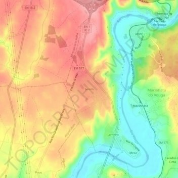
Name: Serém topographic map, elevation, terrain.
Location: Serém, Macinhata do Vouga, Águeda, Aveiro, 3750-993, Portugal (40.63619 -8.49357 40.67619 -8.45357)
Average elevation: 68 m
Minimum elevation: 3 m
Maximum elevation: 124 m
Thank you for supporting this site ❤️
Make a donation
Make a donation
Gear up for your next adventure:
As an Amazon Associate, this site earns from qualifying purchases at no extra cost to you.