Geolocate

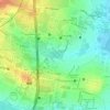
Bylahalli topographic map

Click on the map to display elevation.

About this map

Name: Bylahalli topographic map, elevation, terrain.

Location: Bylahalli, Yelahanka taluku, Bengaluru Urban, Karnataka, 560300, India (13.14905 77.66082 13.18905 77.70082)

Average elevation: 898 m

Minimum elevation: 880 m

Maximum elevation: 921 m

Other topographic maps

Click on a map to view its topography, its elevation and its terrain.

Yelahanka Zone

India > Karnataka > Yelahanka taluku > Bellahalli

Average elevation: 910 m

Arakere

India > Karnataka > Yelahanka taluku

Average elevation: 881 m

Vidyaranyapura

India > Karnataka > Yelahanka taluku > Bengaluru

Average elevation: 920 m

Bilijaji

India > Karnataka > Yelahanka taluku

Average elevation: 865 m

Amruthalli Lake

India > Karnataka > Yelahanka taluku > Bengaluru

Average elevation: 906 m

Yelahanka Lake

India > Karnataka > Yelahanka taluku > Nagenahalli

Average elevation: 904 m

Kodigehalli

India > Karnataka > Yelahanka taluku > Bengaluru

Average elevation: 906 m

Soladevanahalli

India > Karnataka > Yelahanka taluku

Average elevation: 864 m

Sonnenahalli

India > Karnataka > Yelahanka taluku

Average elevation: 888 m

Allalasandra Lake

India > Karnataka > Yelahanka taluku

Average elevation: 915 m

Gear up for your next adventure:

🧢Outdoor Visor - Breathable visor for sunny hikes
🧥Thermal Layer - Insulating layer for cold outdoor conditions
🧣Evaporative Cooling Towel - Beat the heat during intense summer climbs
🦶Anti-Blister Balm - Prevents friction and hotspots during long ascents
🐕Hiking Dog Pack - Let your canine companion carry their own water and food

As an Amazon Associate, this site earns from qualifying purchases at no extra cost to you.