
Thank you for supporting this site ❤️
Make a donation
Make a donation
Gear up for your next adventure:
As an Amazon Associate, this site earns from qualifying purchases at no extra cost to you.
Sant'Onofrio topographic map
Click on the map to display elevation.
Thank you for supporting this site ❤️
Make a donation
Make a donation
Gear up for your next adventure:
As an Amazon Associate, this site earns from qualifying purchases at no extra cost to you.
About this map
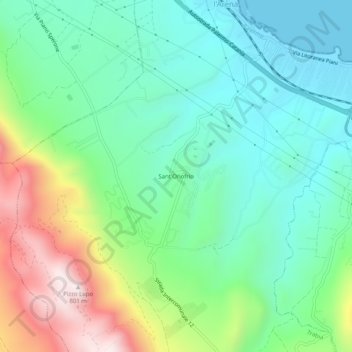
Name: Sant'Onofrio topographic map, elevation, terrain.
Location: Sant'Onofrio, Trabia, Palermo, Sicilia, 90019, Italia (37.97508 13.58725 38.01508 13.62725)
Average elevation: 237 m
Minimum elevation: 0 m
Maximum elevation: 785 m
Thank you for supporting this site ❤️
Make a donation
Make a donation
Gear up for your next adventure:
As an Amazon Associate, this site earns from qualifying purchases at no extra cost to you.