Geolocate

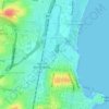
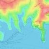
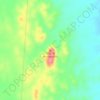
Kanwal topographic map

Click on the map to display elevation.

About this map

Name: Kanwal topographic map, elevation, terrain.

Location: Kanwal, Central Coast Council, New South Wales, 2259, Australia (-33.27293 151.46996 -33.24958 151.49713)

Average elevation: 23 m

Minimum elevation: 0 m

Maximum elevation: 67 m

Other topographic maps

Click on a map to view its topography, its elevation and its terrain.
Rose Seidler House

Australia > New South Wales > Sydney

Average elevation: 153 m

Grafton

Australia > New South Wales

Average elevation: 36 m

Mount Annan

Australia > New South Wales > Sydney

Average elevation: 115 m

Herron Park

Australia > New South Wales > Sydney

Average elevation: 28 m

Dark Gully Reserve

Australia > New South Wales > Sydney

Average elevation: 14 m

Poley Mountain

Australia > New South Wales

Average elevation: 465 m

Castle Mountain

Australia > New South Wales > Quirindi

Average elevation: 578 m

Comara

Australia > New South Wales

Average elevation: 909 m

Gear up for your next adventure:

🛰️Satellite Messenger - Emergency communication for areas with no cell service
🥾Hiking Leggings - Comfortable leggings for outdoor activities
🧣Evaporative Cooling Towel - Beat the heat during intense summer climbs
🎒Hiking Backpack - Lightweight and ergonomic backpacks for day hikes or multi-day treks
💧Hydration Pack - Hands-free hydration system for long hikes

As an Amazon Associate, this site earns from qualifying purchases at no extra cost to you.