Geolocate

Tortora topographic map

Click on the map to display elevation.

About this map

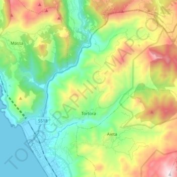
Name: Tortora topographic map, elevation, terrain.

Location: Tortora, Cosenza, Calabria, Italy (39.90774 15.75644 40.00530 15.89885)

Average elevation: 491 m

Minimum elevation: -1 m

Maximum elevation: 1,456 m

Other topographic maps

Click on a map to view its topography, its elevation and its terrain.

Savuto

Italy > Calabria > Cosenza > Cleto

Average elevation: 284 m

Lago dell'Esaro

Italy > Calabria > Cosenza > Roggiano Gravina

Average elevation: 156 m

Gear up for your next adventure:

🧦Hiking Liner Socks - Thin base layer to prevent friction and blisters
🔦LED Headtorch - Bright and durable light for night activities
🧴First Aid Kit - Essential first aid supplies for outdoor emergencies
🧊Portable Cooler - Keep food and drinks cold during outdoor adventures
🧭GPS Tracker - Track your location in remote areas safely

As an Amazon Associate, this site earns from qualifying purchases at no extra cost to you.