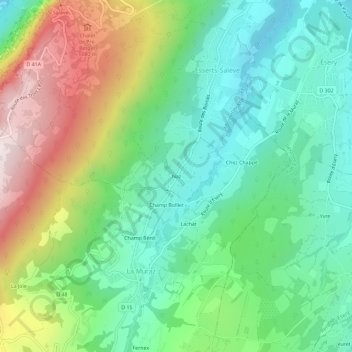
Geolocate

Naz topographic map

Click on the map to display elevation.

About this map

Name: Naz topographic map, elevation, terrain.

Location: Naz, Esserts-Salève, Monnetier-Mornex, Saint-Julien-en-Genevois, Haute-Savoie, Auvergne-Rhône-Alpes, France métropolitaine, 74560, France (46.11494 6.19218 46.15494 6.23218)

Average elevation: 776 m

Minimum elevation: 510 m

Maximum elevation: 1,289 m

Other topographic maps

Click on a map to view its topography, its elevation and its terrain.

Gear up for your next adventure:

Tent Footprint - Protect tent floor and increase durability
🧊Insulated Water Bottle - Keeps drinks cold in summer and prevents freezing in winter
📷Outdoor Action Camera - Capture high-elevation views and rugged adventures
🧴Sunscreen SPF - Broad-spectrum sunscreen for outdoor activities
💡Portable Camping Lamp - Rechargeable lamp for campsite lighting

As an Amazon Associate, this site earns from qualifying purchases at no extra cost to you.