
Shispur topographic map
Interactive map
Click on the map to display elevation.
About this map
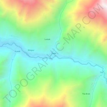
Name: Shispur topographic map, elevation, terrain.
Location: Shispur, Kargil District, Jammu-et-Cachemire, Inde (34.21665 76.06940 34.25665 76.10940)
Average elevation: 3,724 m
Minimum elevation: 3,245 m
Maximum elevation: 4,658 m