Geolocate

Corella topographic map

Click on the map to display elevation.

About this map

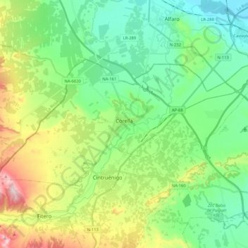
Name: Corella topographic map, elevation, terrain.

Location: Corella, Erribera / Ribera, 31591, Spain (42.07227 -1.89733 42.15357 -1.68896)

Average elevation: 377 m

Minimum elevation: 261 m

Maximum elevation: 648 m

Gear up for your next adventure:

Lightweight Backpacking Tent - Compact tent for efficient hiking trips
🥾Hiking Shorts - Breathable shorts suitable for summer hikes
🥾Waterproof Hiking Shoes - Durable shoes for wet and rugged trails
🥾Trekking Poles - Adjustable trekking poles to reduce knee stress and improve stability
💧Hydration Bladder - Hands-free hydration solution for long treks

As an Amazon Associate, this site earns from qualifying purchases at no extra cost to you.