Geolocate

Dhawa topographic map

Interactive map

Click on the map to display elevation.

About this map

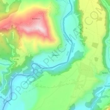
Name: Dhawa topographic map, elevation, terrain.

Location: Dhawa, Bhimsen-04, Bhimsen, Gorkha, Gandaki Province, Nepal (27.98536 84.78619 28.02536 84.82619)

Average elevation: 593 m

Minimum elevation: 420 m

Maximum elevation: 913 m

Other topographic maps

Click on a map to view its topography, its elevation and its terrain.

Manaslu

Nepal > Gandaki Province > Gorkha

The Manaslu region offers a variety of trekking options. The popular Manaslu trekking route of 177 kilometres (110 mi) skirts the Manaslu massif over the pass down to Annapurna. The Nepalese Government only permitted trekking on this circuit in 1991. The trekking trail follows an ancient salt-trading route…

Average elevation: 7,069 m