Geolocate

Muara Payang topographic map

Click on the map to display elevation.

About this map

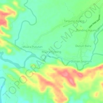
Name: Muara Payang topographic map, elevation, terrain.

Location: Muara Payang, Bengkulu Selatan, Bengkulu, Sumatra, Indonesia (-4.48206 102.96831 -4.44206 103.00831)

Average elevation: 41 m

Minimum elevation: 9 m

Maximum elevation: 96 m

Gear up for your next adventure:

🧥Packable Rain Jacket - Breathable waterproof layer for unpredictable weather
🦶Anti-Blister Balm - Prevents friction and hotspots during long ascents
💧Hydration Pack - Hands-free hydration system for long hikes
🥾Hiking Boots - Sturdy boots providing ankle support and traction on rugged trails
🥾Waterproof Trail Shoes - Shoes designed to handle wet terrain

As an Amazon Associate, this site earns from qualifying purchases at no extra cost to you.