Geolocate

Punta Lomitas topographic map

Click on the map to display elevation.

About this map

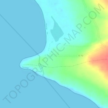
Name: Punta Lomitas topographic map, elevation, terrain.

Location: Punta Lomitas, Ocucaje, Province of Ica, Ica, Peru (-14.72295 -75.85686 -14.70295 -75.83686)

Average elevation: 13 m

Minimum elevation: 0 m

Maximum elevation: 63 m

Gear up for your next adventure:

🥾All-Terrain Hiking Boots - Versatile boots for varied hiking conditions
🧢Sun Protection Cap - Breathable cap to protect from sun exposure
💡Compact LED Flashlight - Powerful and portable flashlight for outdoor use
🎒Fully Waterproof Backpack - Total protection for photography gear and electronics
🔋Lithium AA Batteries - Long-lasting power that performs in extreme cold

As an Amazon Associate, this site earns from qualifying purchases at no extra cost to you.