
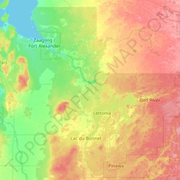
Rural Municipality of Alexander topographic map
Interactive map
Click on the map to display elevation.
About this map
Name: Rural Municipality of Alexander topographic map, elevation, terrain.
Average elevation: 263 m
Minimum elevation: 215 m
Maximum elevation: 347 m
Division No. 1 trails, hiking, mountain biking, running and outdoor activities
Other topographic maps
Click on a map to view its topography, its elevation and its terrain.
West Hawk Lake
Canada > Manitoba > Division No. 1 > Unorganized Division No. 1
Average elevation: 349 m
Hillside Beach
Canada > Manitoba > Division No. 1 > Rural Municipality of Alexander
Average elevation: 225 m
Bird River
Canada > Manitoba > Division No. 1 > Rural Municipality of Alexander
Average elevation: 287 m
East Braintree
Canada > Manitoba > Division No. 1 > Rural Municipality of Reynolds
Average elevation: 317 m