
Nuevo Chao topographic map
Interactive map
Click on the map to display elevation.
About this map
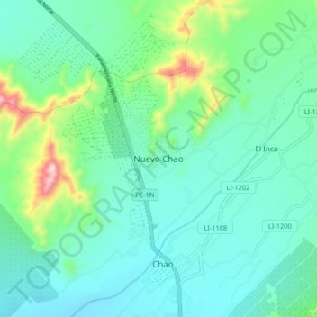
Name: Nuevo Chao topographic map, elevation, terrain.
Location: Nuevo Chao, Chao, Virú, La Libertad, Peru (-8.55244 -78.72017 -8.47244 -78.64017)
Average elevation: 148 m
Minimum elevation: 56 m
Maximum elevation: 495 m