Geolocate

Lesteven topographic map

Click on the map to display elevation.

About this map
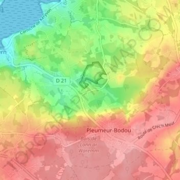
Name: Lesteven topographic map, elevation, terrain.

Location: Lesteven, Pleumeur-Bodou, Lannion, Côtes-d'Armor, Bretagne, France métropolitaine, 22560, France (48.76212 -3.54508 48.80212 -3.50508)

Average elevation: 59 m

Minimum elevation: 0 m

Maximum elevation: 104 m

Other topographic maps

Click on a map to view its topography, its elevation and its terrain.

22560

France > Bretagne > Côtes-d'Armor > Pleumeur-Bodou

Average elevation: 41 m

Gear up for your next adventure:

🧤Rechargeable Heated Gloves - Extreme warmth for Canadian winter expeditions
🥾Trail Hiking Boots - Supportive boots for rough trails
🧢Beanie Hat - Keep your head warm in cold weather
💡LED Headlamp - Hands-free illumination for night hiking and camping
🚲Handlebar Phone Mount - View topographic-map.com live while cycling

As an Amazon Associate, this site earns from qualifying purchases at no extra cost to you.