Geolocate

Chitarpur topographic map

Click on the map to display elevation.

Chitarpur

Chitarpur is located at 23°34′30″N 85°39′17″E / 23.5749°N 85.6548°E / 23.5749; 85.6548. It has an average elevation of 364 metres (1167 feet).

Wikipedia (CC-BY-SA 3.0)

About this map

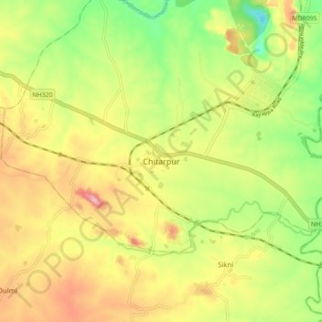
Name: Chitarpur topographic map, elevation, terrain.

Location: Chitarpur, Ramgarh, Jharkhand, India (23.53298 85.61353 23.61298 85.69353)

Average elevation: 344 m

Minimum elevation: 252 m

Maximum elevation: 440 m

Gear up for your next adventure:

🩹Moleskin Blister Pads - Direct protection for painful foot pressure points
💧Collapsible Water Bottle - Space-saving water bottle for outdoor activities
🏃Hydration Running Vest - Carry water and maps close to your body for speed
🛶Kayak Dry Bag - Waterproof storage for kayaking adventures
🧴Bear Spray Holster - Quick-access carry for essential Canadian wilderness safety

As an Amazon Associate, this site earns from qualifying purchases at no extra cost to you.