
Striep topographic map
Interactive map
Click on the map to display elevation.
About this map
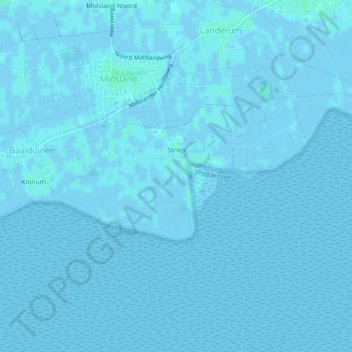
Name: Striep topographic map, elevation, terrain.
Location: Striep, Terschelling, Friesland, Nederland (53.36980 5.27642 53.38088 5.30029)
Average elevation: 0 m
Minimum elevation: -3 m
Maximum elevation: 4 m
Other topographic maps
Click on a map to view its topography, its elevation and its terrain.
West-Terschelling
Nederland > Friesland > Terschelling
West-Terschelling, Terschelling, Friesland, Nederland
Average elevation: 0 m
Kinnum
Nederland > Friesland > Terschelling > Kinnum
Kinnum, Terschelling, Friesland, Nederland
Average elevation: 1 m
Griend
Nederland > Friesland > Terschelling
Griend, Terschelling, Friesland, Nederland
Average elevation: 0 m