Geolocate

Geger topographic map

Click on the map to display elevation.

About this map

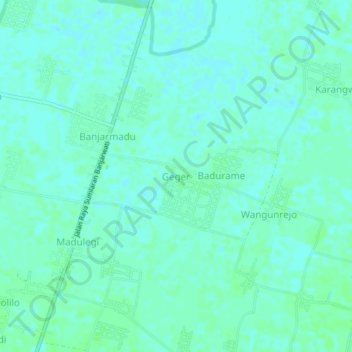
Name: Geger topographic map, elevation, terrain.

Location: Geger, Lamongan, East Java, Java, 62252, Indonesia (-7.09070 112.32816 -7.05070 112.36816)

Average elevation: 4 m

Minimum elevation: 1 m

Maximum elevation: 8 m

Other topographic maps

Click on a map to view its topography, its elevation and its terrain.

Bluluk

Indonesia > East Java > Lamongan

Average elevation: 73 m

Sukorame

Indonesia > East Java > Lamongan

Average elevation: 101 m

Jejel

Indonesia > East Java > Lamongan > Ngimbang

Average elevation: 80 m

Wonorejo

Indonesia > East Java > Lamongan > Sambeng

Average elevation: 81 m

Ngimbang

Indonesia > East Java > Lamongan

Average elevation: 89 m

Pamotan

Indonesia > East Java > Lamongan > Sambeng

Average elevation: 78 m

Garung

Indonesia > East Java > Lamongan > Sambeng

Average elevation: 76 m

Sambeng

Indonesia > East Java > Lamongan

Average elevation: 79 m

Pataan

Indonesia > East Java > Lamongan > Sambeng

Average elevation: 102 m

Selorejo

Indonesia > East Java > Lamongan > Sambeng

Average elevation: 55 m

Gear up for your next adventure:

🐕Hiking Dog Pack - Let your canine companion carry their own water and food
🔥Emergency Fire Starter - Reliable ignition source for all weather conditions
🔦LED Headtorch - Bright and durable light for night activities
🕯️Camping Lantern - Illuminates your entire campsite with high-efficiency LEDs
🕶️Polarized Sunglasses - Protect your eyes with durable polarized lenses

As an Amazon Associate, this site earns from qualifying purchases at no extra cost to you.