Geolocate

Godong topographic map

Click on the map to display elevation.

About this map

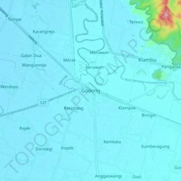
Name: Godong topographic map, elevation, terrain.

Location: Godong, Grobogan, Central Java, Java, Indonesia (-7.06182 110.72975 -6.98182 110.80975)

Average elevation: 18 m

Minimum elevation: 9 m

Maximum elevation: 170 m

Gear up for your next adventure:

🕶️Polarized Sunglasses - Protect your eyes with durable polarized lenses
🧦Hiking Socks - Moisture-wicking and comfortable socks for long hikes
🥾Trail Running Boots - Durable shoes designed for trail running
🧼Travel Hand Sanitizer - Keep hands clean when water is scarce
💧Hydration Bladder - Hands-free hydration solution for long treks

As an Amazon Associate, this site earns from qualifying purchases at no extra cost to you.