
Thank you for supporting this site ❤️
Make a donation
Make a donation
Gear up for your next adventure:
As an Amazon Associate, this site earns from qualifying purchases at no extra cost to you.
Maputsoe topographic map
Click on the map to display elevation.
Thank you for supporting this site ❤️
Make a donation
Make a donation
Gear up for your next adventure:
As an Amazon Associate, this site earns from qualifying purchases at no extra cost to you.
About this map
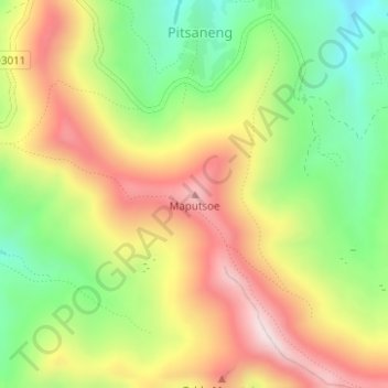
Name: Maputsoe topographic map, elevation, terrain.
Location: Maputsoe, Pitsaneng, Thaba-Tseka District, Lesotho (-29.58732 28.84314 -29.58722 28.84324)
Average elevation: 2,650 m
Minimum elevation: 2,407 m
Maximum elevation: 2,908 m
Thank you for supporting this site ❤️
Make a donation
Make a donation
Gear up for your next adventure:
As an Amazon Associate, this site earns from qualifying purchases at no extra cost to you.