Geolocate

Leeward Islands topographic map

Click on the map to display elevation.

About this map

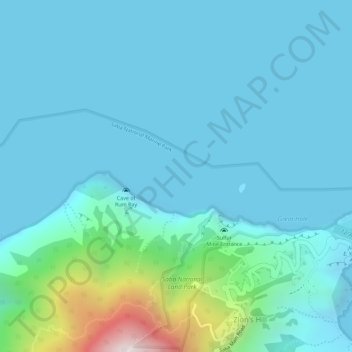
Name: Leeward Islands topographic map, elevation, terrain.

Location: Leeward Islands, Zion's Hill, Saba, Netherlands (17.64995 -63.23505 17.65005 -63.23495)

Average elevation: 112 m

Minimum elevation: 0 m

Maximum elevation: 795 m

Gear up for your next adventure:

🛶Waterproof Dry Bags - Keep electronics and clothes dry during river crossings
🧥Softshell Jacket - Windproof and breathable jacket for hiking
🔋Lithium AA Batteries - Long-lasting power that performs in extreme cold
🎒Hiking Daypack - Lightweight and durable backpacks for day trips and excursions
🚲Bike Repair Kit - Essential tools for on-trail mechanical issues

As an Amazon Associate, this site earns from qualifying purchases at no extra cost to you.