
Thank you for supporting this site ❤️
Make a donation
Make a donation
Gear up for your next adventure:
As an Amazon Associate, this site earns from qualifying purchases at no extra cost to you.
Klingenkopf topographic map
Click on the map to display elevation.
Thank you for supporting this site ❤️
Make a donation
Make a donation
Gear up for your next adventure:
As an Amazon Associate, this site earns from qualifying purchases at no extra cost to you.
About this map
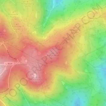
Name: Klingenkopf topographic map, elevation, terrain.
Location: Klingenkopf, Neu-Anspach, Hochtaunuskreis, Hessen, Deutschland (50.24766 8.50301 50.24776 8.50311)
Average elevation: 589 m
Minimum elevation: 450 m
Maximum elevation: 707 m
Thank you for supporting this site ❤️
Make a donation
Make a donation
Gear up for your next adventure:
As an Amazon Associate, this site earns from qualifying purchases at no extra cost to you.
Other topographic maps
Click on a map to view its topography, its elevation and its terrain.