Geolocate

Bergua topographic map

Click on the map to display elevation.

About this map

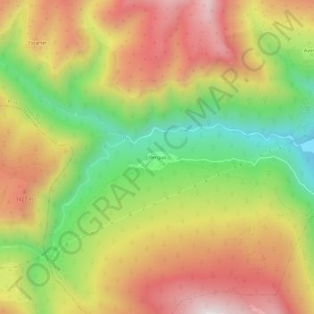
Name: Bergua topographic map, elevation, terrain.

Location: Bergua, Broto, Sobrarbe, Huesca, Aragón, 22372, España (42.51427 -0.19010 42.55427 -0.15010)

Average elevation: 1,232 m

Minimum elevation: 814 m

Maximum elevation: 1,628 m

Gear up for your next adventure:

🔦LED Flashlight - Powerful and long-lasting flashlight for camping and emergencies
🥘Camping Cookware Set - Compact nesting pots and pans for trail cooking
🧦Hiking Socks - Moisture-wicking and comfortable socks for long hikes
🧰Survival Kit - Essential gear for emergencies in the wilderness
💡LED Camping Lantern - Illuminate your campsite with long-lasting lanterns

As an Amazon Associate, this site earns from qualifying purchases at no extra cost to you.