
Freedom topographic map
Click on the map to display elevation.
About this map
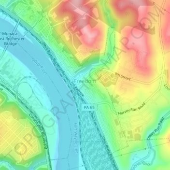
Name: Freedom topographic map, elevation, terrain.
Location: Freedom, Beaver County, Pennsylvania, United States (40.67396 -80.26608 40.69589 -80.24267)
Average elevation: 263 m
Minimum elevation: 204 m
Maximum elevation: 356 m
Other topographic maps
Click on a map to view its topography, its elevation and its terrain.
Big Knob
United States > Pennsylvania > Beaver County > New Sewickley Township
Average elevation: 345 m