Geolocate

Lincoln topographic map

Click on the map to display elevation.

About this map

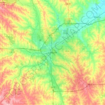
Name: Lincoln topographic map, elevation, terrain.

Location: Lincoln, Lancaster County, Nebraska, 68508, United States (40.64889 -96.86778 40.96889 -96.54778)

Average elevation: 387 m

Minimum elevation: 336 m

Maximum elevation: 459 m

Other topographic maps

Click on a map to view its topography, its elevation and its terrain.

Gear up for your next adventure:

🧥Waterproof Pants - Keep dry during rainy hiking conditions
Lightweight Camping Tent - Portable shelter optimized for Canadian backcountry camping
🛌Insulated Sleeping Pad - Critical thermal barrier between you and the cold ground
🏃Hydration Running Vest - Carry water and maps close to your body for speed
🔥Emergency Fire Starter - Reliable ignition source for all weather conditions

As an Amazon Associate, this site earns from qualifying purchases at no extra cost to you.