
Thank you for supporting this site ❤️
Make a donation
Make a donation
Gear up for your next adventure:
As an Amazon Associate, this site earns from qualifying purchases at no extra cost to you.
Paravoor topographic map
Click on the map to display elevation.
Thank you for supporting this site ❤️
Make a donation
Make a donation
Gear up for your next adventure:
As an Amazon Associate, this site earns from qualifying purchases at no extra cost to you.
About this map
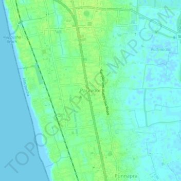
Name: Paravoor topographic map, elevation, terrain.
Location: Paravoor, Ambalappuzha, Alappuzha, Kerala, 688014, India (9.43217 76.32207 9.47217 76.36207)
Average elevation: 5 m
Minimum elevation: -2 m
Maximum elevation: 12 m
Thank you for supporting this site ❤️
Make a donation
Make a donation
Gear up for your next adventure:
As an Amazon Associate, this site earns from qualifying purchases at no extra cost to you.